Marine Traffic Map
Search by MMSI or IMO number
BITCOIN PRICE
The system is based on Automatic Identification System (AIS). Receiving stations cover the entire range of 40 nautical miles (about 75 km) and periodically receive information from some more remote vessels. Read more about AIS on Wikipedia
It is difficult to determine the maximum coverage area, but it can be imagined in this example: a vessel with an AIS transmitter connected to an external antenna located at a height of 15 meters above sea level will be able to exchange a signal with the coastal AIS station at a distance of 15-20 nautical miles (approximately 28-38 km). The higher the AIS stations are, both shipboard and shore, the further the radio signal will spread.
The reception quality also depends on the type of antenna, obstacles (mountains, buildings) and current weather conditions. In some cases, ships can be seen on the map at a distance of 200 nautical miles (370 km!), if the antenna with the AIS receiver is located high enough (for example, on a mountain over 500 m).
In general, the data on the map is updated in real time. However, the positions of some vessels may be updated with a delay, for example, when the vessel has exceeded the receiving range. Also, some items may be displayed with a delay of up to one hour, which is not a big error if the ship is in the ocean (considering the small speed of the ships and the huge distances).
Our Norwegian client is looking for a Single Engineer to join a General Cargo vessel. Requirements: Min. 2 contract on similar type of vessel and …
Urgently searching for AB for AHT. Start 29/09/25, duration 5 weeks, salary 160-180 euro pd. Vessel flag- Netherlands. Several years working on workbo…
☆Старший механик (Chief Engineer)☆, оклад $ 6.500 / в месяц ▫️ Посадка: середина октября 2025 года ⚡️️⚡️️⚡️️ — Сухогруз (General Cargo) ▫️ …
On behalf of our respective client, we are looking for an experienced Stewardess to join MPSV. Requirements: Previous experience in rank; Good co…
☆Капитан (Master)☆, оклад $ 6.500 / в месяц ▫️ Посадка: конец октября 2025 года ⚡️️⚡️️⚡️️ — Балкер (Bulk Carrier) ▫️ DWT: 8.184 ▫️ GT: 5.222…
Searching for CH ENG for Multicat DP2. Start mid of October, rotation 8/8 weeks, salary 350 euro pd, ADNOC. Please contact with us in any additional …
Steward(-ess) is wanted to join Gas Tanker. Opportunity to join Floating LNG platform. Respectable project and company with very good conditions. …
Our respective Client is looking for an experienced Chief Engineer to join an AHTS DP-1 vessel. Permanent rotation possibility. Requirements: All …
Searching for CH OFF for GC. Start 10th of November, duration 6 weeks, salary 220 euro pd. Must have good English. Location - Europe. Flag - Netherlan…
Urgently searching for AB for Accomodation barge. Start ASAP, rotation 8/8 weeks, salary 180 euro pd. Previous experience on an barge vessels. Locatio…
Работа в море
Не ждите, пока появятся новые вакансии. Начинайте активный поиск уже сегодня!
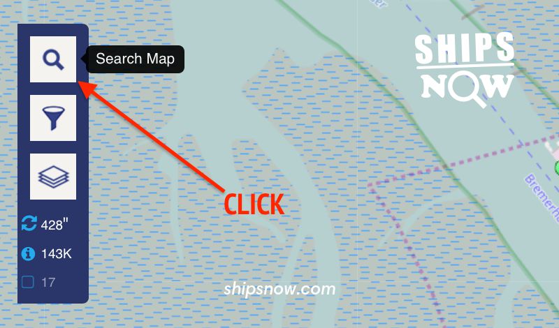
To find a vessel on AIS map, you need to enter its name (or part of it) as shown in the pictures below. Click on the icon with the magnifying glass icon to display the input form. Then start entering the name of the vessel in the upper field, where it is written Vessel, Port.
 How to activate ship search
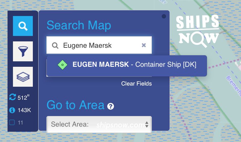
If the vessel is within reach of the AIS station, its name will appear in the drop-down list. Click on the name in the list and you will see the vessel on the map.
 m/v Eugen Maersk is within the AIS coverage area
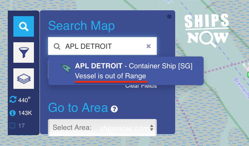
If the vessel is found in the database, but at the moment is out of reach of AIS, you will see note Vessel is out of Range. Try again later.
 m/v APL Detroit is outside of the AIS coverage area
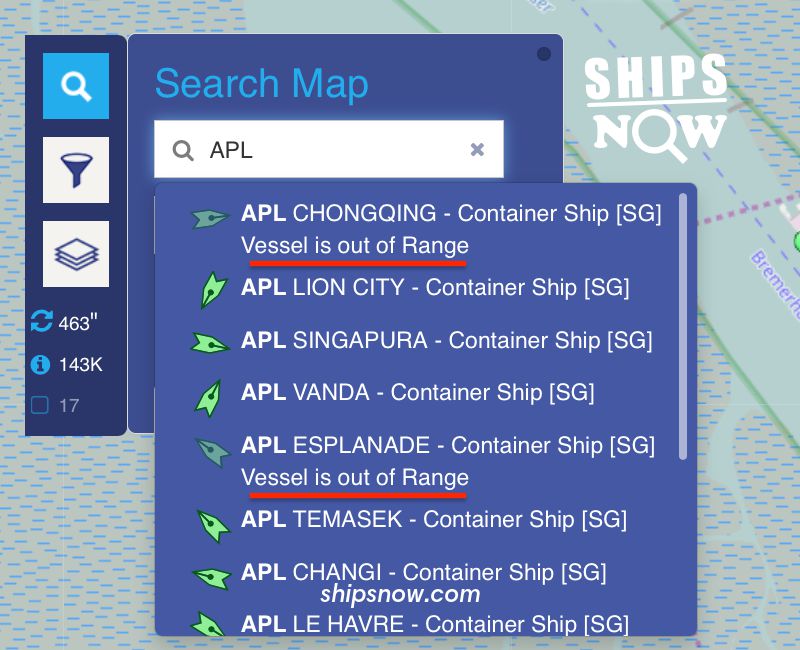
As can be seen from the example below, the name of the vessel may be entered partially.
If the vessel is found in the database, but at the moment is out of reach of AIS, you will see note Vessel is out of Range. Try again later.
 Found ships with names starting with APL